Route Choice Exercises
These route choice exercises were created by Simon Fraser University's Avalanche Research Program to test your ability to incorporate information from the avalanche forecast into your daily trip planning. You will take the information from the forecast and use it to decide which terrain you choose to ride, and which you choose to avoid. Please note that while these work on mobile devices, they're easier to use on desktop computers.
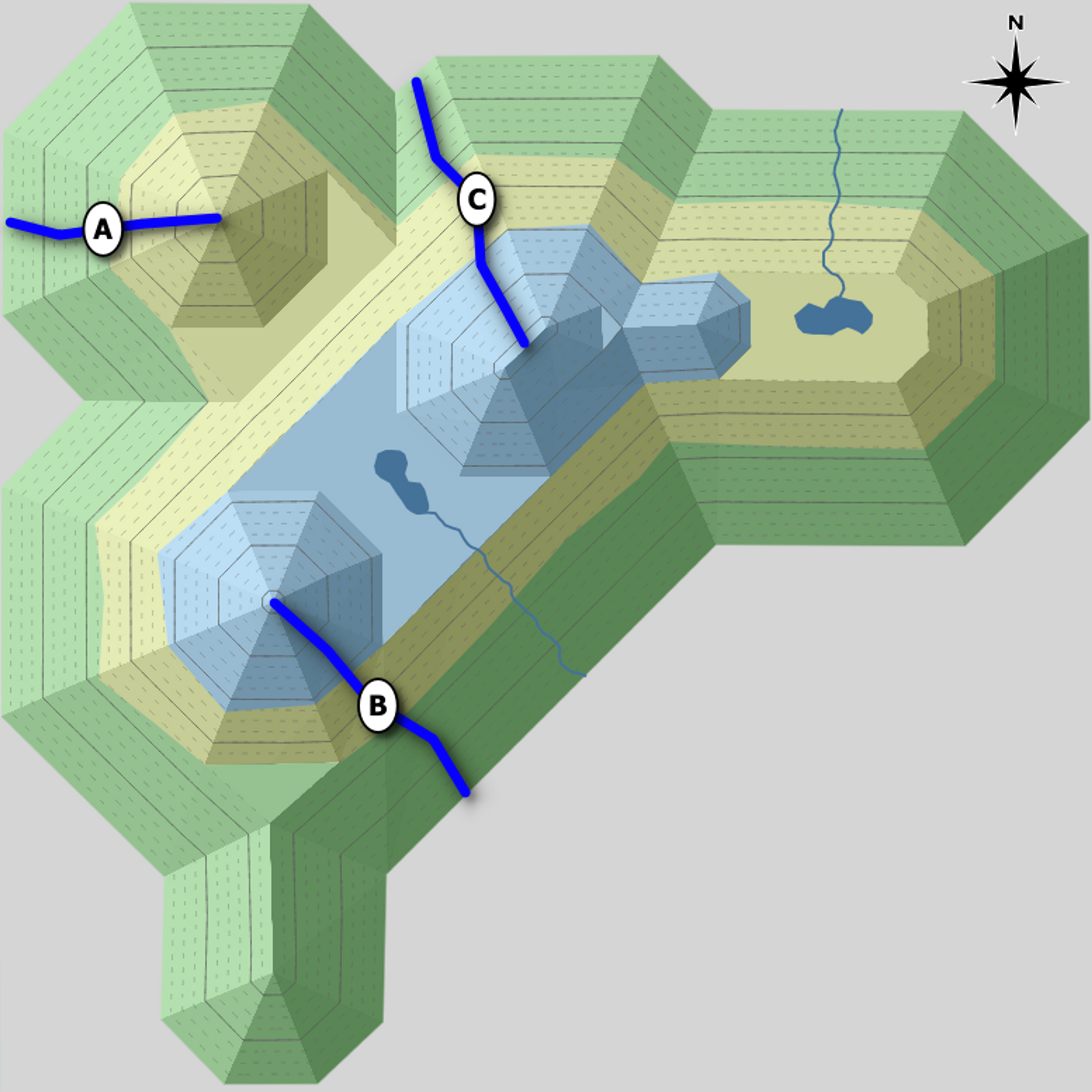
The avalanche forecast shows the danger rating for all three elevation bands; and the elevation and aspect of up to two avalanche problems. The terrain model shows three different route options. Assume the sloped areas on the model contain avalanche terrain. The blue areas are alpine, the yellow are treeline, and the green are below treeline.
Your goal is to rank the routes on the terrain model in order from least exposed to most exposed based on the avalanche forecast.
Have fun!
Quiz
Avalanche Forecast
- Alpine
- Considerable
- Treeline
- Considerable
- Below Treeline
- Moderate
Storm Slab 
What Elevation? 
Which Slopes? Wet Loose 
What Elevation? 
Which Slopes?
Terrain

Ranking
Rank the three routes on the terrain model from least exposed to most exposed to avalanche danger based on the avalanche forecast.
Quiz
Avalanche Forecast
- Alpine
- Moderate
- Treeline
- Moderate
- Below Treeline
- Low
Persistent Slab What Elevation? Which Slopes? Wind Slab 
What Elevation? 
Which Slopes?
Terrain

Ranking
Rank the three routes on the terrain model from least exposed to most exposed to avalanche danger based on the avalanche forecast.
Quiz
Avalanche Forecast
- Alpine
- Considerable
- Treeline
- Considerable
- Below Treeline
- High
Wet Loose What Elevation? 
Which Slopes? Wind Slab What Elevation? 
Which Slopes?
Terrain
Ranking
Rank the three routes on the terrain model from least exposed to most exposed to avalanche danger based on the avalanche forecast.
Quiz
Avalanche Forecast
- Alpine
- High
- Treeline
- High
- Below Treeline
- Considerable
Storm Slab 
What Elevation? Which Slopes?
Terrain

Ranking
Rank the three routes on the terrain model from least exposed to most exposed to avalanche danger based on the avalanche forecast.
Quiz
Avalanche Forecast
- Alpine
- Moderate
- Treeline
- Considerable
- Below Treeline
- Moderate
Persistent Slab What Elevation? 
Which Slopes? Wind Slab What Elevation? Which Slopes?
Terrain

Ranking
Rank the three routes on the terrain model from least exposed to most exposed to avalanche danger based on the avalanche forecast.