Online Trip Planner
Another easy way to figure out how appropriate a trip is for the day’s avalanche conditions is to use the online trip planner. Once you select your destination, this tool automatically applies the current avalanche danger rating for the region and places the trip in the appropriate position on the Avaluator chart.
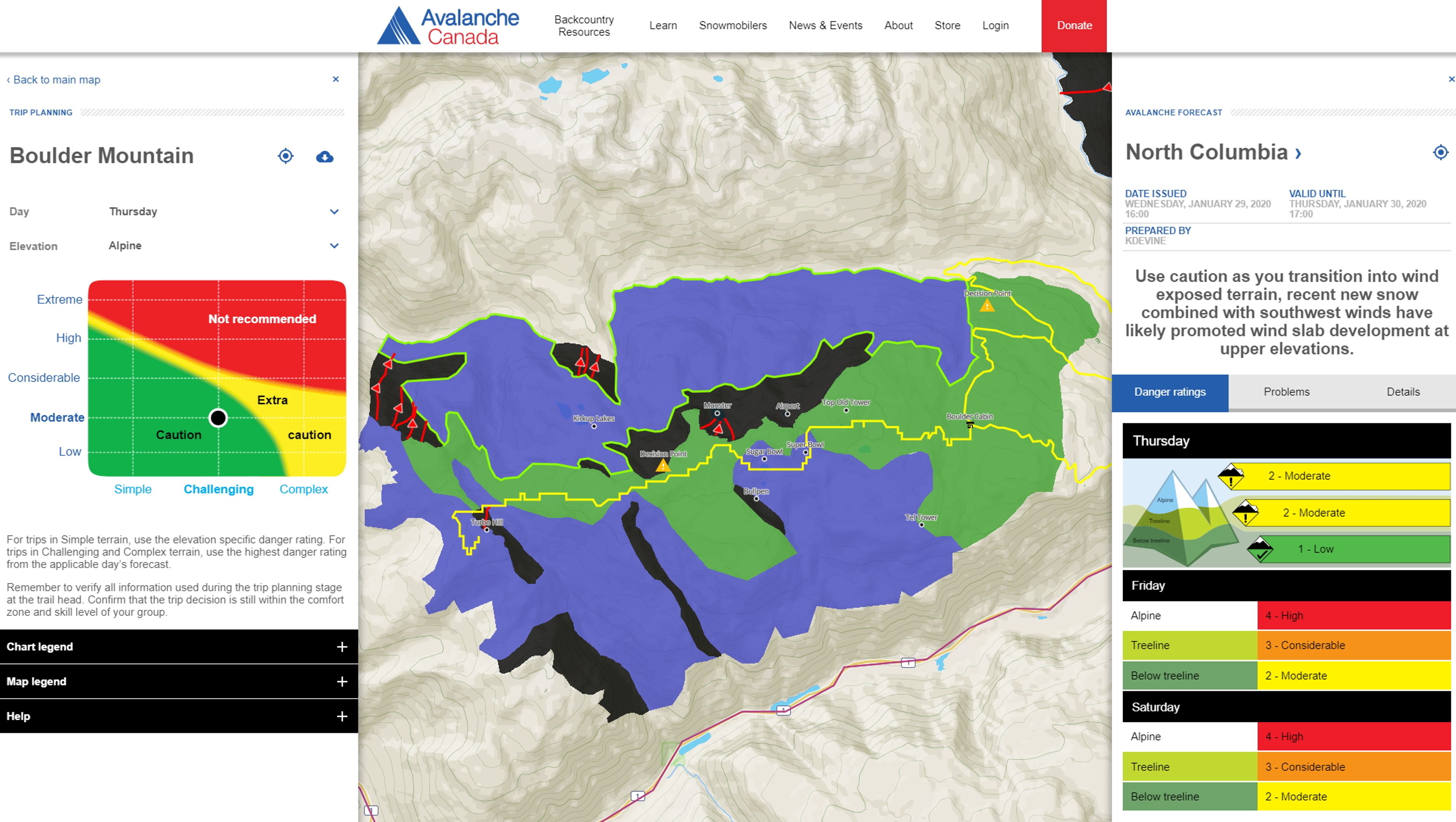
The online trip planner includes the ATES ratings for mapped areas, the location of major avalanche paths, main access trails, and key decision points. You can download the maps so you can use them offline. With the appropriate mapping software on your phone or GPS device, you can see when you’re transitioning between simple, challenging, and complex terrain.
Hover over or tap on the icons to learn more about the different elements of the ATES map.
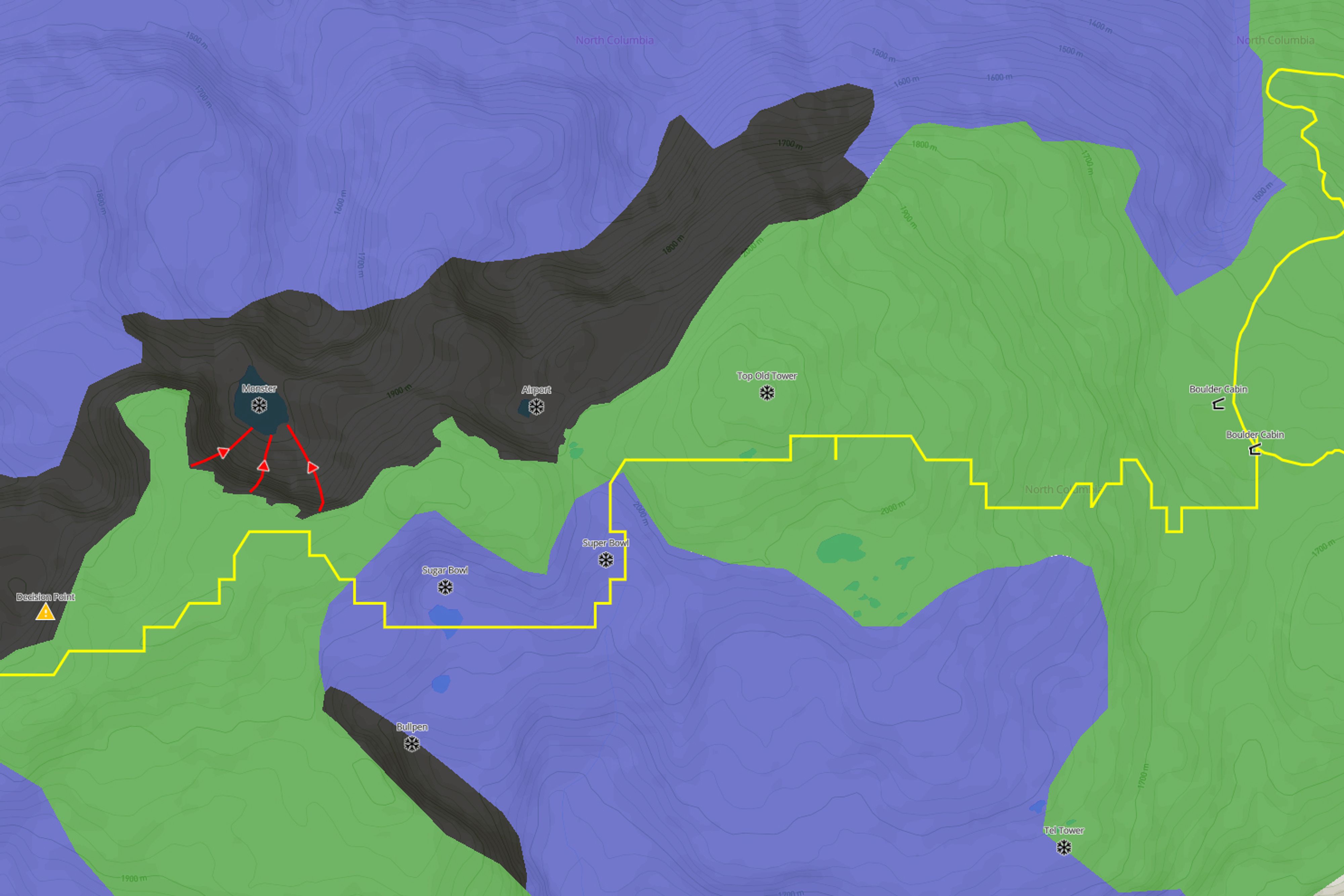 The yellow lines are designated trails.
 The online trip planner works for ATES-rated areas. This includes all managed snowmobiling areas in BC, several BC provincial parks, and a few popular backcountry skiing spots. There are also ATES ratings for the mountainous areas of western Newfoundland, in and around Gros Morne National Park.
If you are planning a trip where there is no ATES rating, you will need advanced training to make your own judgment regarding how exposed the terrain is to avalanche hazard.